Eureka live webcam – Buoy 46022: Eel River - 17nm Wsw Of Eureka, CA
Working Still image · every hour Open ocean · Official source · What camera types mean
What you are looking at
Station 46022, the Eel River buoy, floats 17 nautical miles west-southwest of Eureka, California, off the Humboldt coast, in about 456 meters (roughly 1,500 feet) of water. The Eel River meets the sea to the east, and Cape Mendocino lies to the south. The coastline may or may not show in the camera's strip of hourly daylight photos; the main view is open ocean.
Boats leaving Humboldt Bay must cross a bar that can be dangerous in big surf, so fishers, the Coast Guard and other mariners watch this buoy's wave readings closely. Maintained by the National Data Buoy Center, the 3-meter foam buoy also reports wind speed and gusts, air pressure, and air and water temperature, all used in National Weather Service marine forecasts.
Winter is stormy, with heavy rain, strong southerly winds and large swell. After big rains the river can stain nearshore waters brown. Summer brings brisk northwest winds and frequent fog that can turn a frame almost completely gray, while fall often offers the calmest, clearest days of the year.
Camera details
- Operator
- NOAA National Data Buoy Center
- Station ID
- 46022
- Station
- EEL RIVER - 17NM WSW of Eureka, CA
- Image size
- 2880 × 300 px (6 frames around the buoy)
- Daylight pictures only
- Yes
- Image updates
- Every hour
- Video format
- Still image (JPEG)
- Position
- Exact (from the provider)
- Licence
- U.S. public domain
- Data source
- NOAA NDBC BuoyCAMs
- Working, last 7 days
- 100 % of checks
From the provider's own camera list and our automatic checks. Readings and details can change without notice.
Live camera in Eureka, California
Eureka is a city in California, United States with about 27,000 people. The camera is about 21 mi from the center. Eureka keeps America/Los Angeles time (UTC−7 at the moment); the panel above shows the local time live.
Eureka is the largest city on California's far north coast and the seat of Humboldt County, about 270 miles north of San Francisco. Around 26,500 people lived in the city at the 2020 census, and the wider area has close to twice that. Founded in 1850 on the shore of Humboldt Bay, Eureka grew rich on redwood timber and fishing. That past still shows in its Victorian houses, above all…
On the map
Live cameras near Eureka
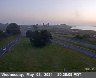
 WorkingStill imageUS-101 at Eureka / Spruce Point, looking North, Eureka
 WorkingStill imageUS-101 at Eureka / Spruce Point, looking South, Eureka
 OfflineStill imageUS-101 at Eureka / Papa & Barkley, looking North, Eureka
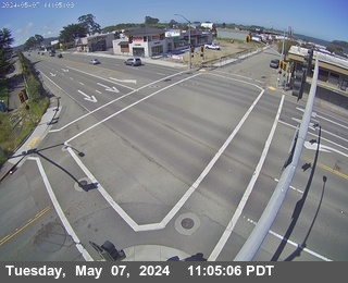
 OfflineStill imageUS-101 at Eureka / Piersons, looking South, Eureka
 OfflineStill imageUS-101 at Eureka / McCullen, looking South, Eureka
 OfflineStill imageUS-101 at Eureka / McCullen (PTZ), South, Eureka
Also nearby: US-101 at Eureka / Spruce Point, looking North, Eureka (18 mi), US-101 at Eureka / Spruce Point, looking South, Eureka (18 mi) and US-101 at Eureka / Papa & Barkley, looking North, Eureka (19 mi).
All Eureka live cameras · Camera radar centered here · More from NOAA BuoyCAMs
More from Eureka
 Live nowLive videoUS-101 at Eureka / 5th&L, looking North, Eureka
 Live nowLive videoUS-101 at Eureka / 4th & L (Looking North), Eureka
 Live nowLive videoUS-101 at Eureka / 5th&L, looking South, Eureka
 Live nowLive videoUS-101 at Eureka / 5th & R Street, looking North, Eureka
 Live nowLive videoUS-101 at Eureka / 4th and Rst Street, looking North, Eureka
 Live nowLive videoUS-101 at Eureka / 5th & V, looking South, Eureka
Questions about Buoy 46022: Eel River - 17nm Wsw Of Eureka, CA
Is the Buoy 46022: Eel River - 17nm Wsw Of Eureka, CA camera live right now?
Yes, it is working: at our last automatic check it was sending new pictures. It is a still image, not video: a new photo arrives about every 1 hour straight from NOAA National Data Buoy Center.
Who runs this camera?
NOAA National Data Buoy Center runs this camera. It is an official source. Its images are in the U.S. public domain. LiveLocation shows them straight from the source with credit. About NOAA BuoyCAMs Watch at the source
Where is the Buoy 46022: Eel River - 17nm Wsw Of Eureka, CA camera?
It is about 21 mi from the center of Eureka, California, United States. Coordinates: 40.716, -124.540. All cameras in Eureka
Is it day or night there now?
Eureka is in the America/Los Angeles time zone. The "Right now" panel above shows the local time live. On October 7 the sun rises at 7:21 AM and sets at 6:50 PM there.
Can I see other cameras nearby?
Yes: 33 other cameras are within 25 miles of this one. The live camera radar shows them all on a map, nearest first. Open the radar here
Does this buoy camera work at night?
No: NOAA BuoyCAMs take pictures only in daylight, so at night the last daytime image stays up. This is NOAA station 46022; its page also has the latest wind, wave and temperature readings. Station 46022 at NOAA
What do the sensors at Buoy 46022: Eel River - 17nm Wsw Of Eureka, CA show?
The latest readings from the provider: Waves: 1.8 m / 5.9 ft, every 8 s from the NNW; Water: 12.5 °C / 54.5 °F; Air: 11.5 °C / 52.7 °F; Wind: 7 km/h / 4 mph from the N, gusts 11 km/h / 7 mph; Air pressure: 1,013.8 hPa / 29.94 inHg. They update with the provider's data, so they can be a few minutes old.