Mount Hood live webcam – Mount Hood: Hood (STAD, Southeast)
Working Still image · every 10 min Volcano · Official source · What camera types mean
What you are looking at
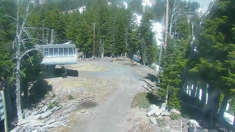
Labeled STAD by the Cascades Volcano Observatory, this camera on the southeast side of Mount Hood, in the Mount Hood Meadows area about 5 km (3 miles) from the summit, gives a clear portrait of the mountain's southeast face. The snowy summit fills the upper left of the frame on clear days, with the Heather Canyon side of the ski area, tall conifers, a lift hut and a service road in the foreground.
Mount Hood last erupted in the 1780s, and its summit area still has fumaroles near Crater Rock, a lava dome from that time. Its main hazards are mudflows and debris flows down valleys such as the White River, which drains this side of the mountain. The USGS keeps the current alert level and updates on its Mount Hood page.
The image here refreshes about every ten minutes. Watch for fresh snow lines in fall, deep winter snowpack, spring corn snow and bare rock with dirty glaciers by late summer. Clouds often build over the summit by midday in summer. Tip: compare it with the nearby Hood Meadows base camera, which shows the lower slopes from a different angle.
Camera details
- Camera ID
- hood-mhm-heather
- Operator
- Cascades Volcano Observatory (USGS)
- Name at the provider
- CVO Hood (STAD, Southeast)
- Volcano
- Mount Hood
- Volcano number (Smithsonian GVP)
- 322010
- Elevation
- 0 m / 0 ft
- Camera faces
- Northwest (318°)
- Image updates
- Every 10 min
- Video format
- Still image (JPEG)
- Position
- Exact (from the provider)
- Licence
- U.S. public domain
- Data source
- USGS volcano webcams
- Working, last 7 days
- Not enough checks yet
From the provider's own camera list and our automatic checks. Readings and details can change without notice.
About Mount Hood, Oregon
Weather now in Mount Hood: 49 °F (10 °C), clear sky, wind 3 mph (5 km/h) from the east. Forecast for 8 PM local time. Weather: MET Norway (CC BY 4.0)
Mount Hood is a place in Oregon, United States. The camera is about 3.0 mi from the center. Mount Hood keeps America/Los Angeles time (UTC−7 at the moment); the panel above shows the local time live.
On the map
Live cameras near Mount Hood
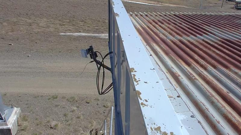
The nearest other cameras are Hood (Mount Hood Meadows, Southeast) (0.6 mi).
All Mount Hood live cameras · Camera radar centered here · More from USGS volcano observatories
Questions about Mount Hood: Hood (STAD, Southeast)
Can I watch Mount Hood: Hood (STAD, Southeast) live right now?
Yes, it is working: at our last automatic check it was sending new pictures. It is a still image, not video: a new photo arrives about every 10 minutes straight from Cascades Volcano Observatory (USGS).
Where does this camera come from?
Cascades Volcano Observatory (USGS) runs this camera, as part of the U.S. Geological Survey (USGS) Volcano Hazards Program. It is an official source. Its images are in the U.S. public domain. LiveLocation shows them straight from the source with credit. About USGS volcano observatories Watch at the source
Where is the Mount Hood: Hood (STAD, Southeast) camera?
It is about 3.0 mi from the center of Mount Hood, Oregon, United States. Coordinates: 45.339, -121.659. All cameras in Mount Hood
Is it day or night there now?
Mount Hood is in the America/Los Angeles time zone. The "Right now" panel above shows the local time live. On October 7 the sun rises at 7:12 AM and sets at 6:35 PM there.
Can I see other cameras nearby?
Yes: 1 other camera is within 25 miles of this one. The live camera radar shows them all on a map, nearest first. Open the radar here
Where can I check the alert level for this volcano?
Cascades Volcano Observatory (USGS) sets the U.S. Volcano Alert Level and Aviation Color Code for this volcano, not LiveLocation. Read its latest update before you plan a visit; the camera alone cannot tell you how safe it is. USGS volcano updates Official camera page
What do the sensors at Mount Hood: Hood (STAD, Southeast) show?
The latest readings from the provider: Volcano alert level: NORMAL · aviation code GREEN; Last USGS notice: Jun 5, 2021, 21:38 local time; Issued by: Cascades Volcano Observatory (USGS). They update with the provider's data, so they can be a few minutes old.