Redoubt (RDJH camera) webcam — United States
Working Still image · every 10 min Volcano · Official source · What camera types mean
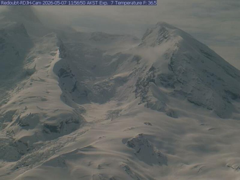
What you are looking at
The standard RDJH camera sits high on a ridge at about 1,410 m (4,640 feet), about 12 km (7.5 miles) north of Redoubt Volcano, and looks south-southeast. It shows Redoubt's upper slopes in close detail: the summit peaks, broad snowfields, crevassed glaciers and the steep north face, which in some frames fill the entire picture.
Redoubt is about 3,100 m (10,200 feet) high and covered in glaciers. During its 2009 eruption, a lava dome grew in the summit crater and explosions sent ash over Anchorage and the Kenai Peninsula. The glaciers on the north side, including the Drift Glacier, were partly melted and torn up, and have been changing since. AVO posts Redoubt's alert level on its website.
The image here refreshes about every ten minutes. Clear days show the glacier textures in detail; snow covers almost everything from fall through spring. Morning light falls from the east, while evening light can paint the summit pink. Tip: when it gets dark, switch to the low-light camera from the same site, which can see more in dim conditions.
Camera details
- Camera ID
- redoubt
- Operator
- Alaska Volcano Observatory (USGS)
- Name at the provider
- Redoubt [RDJH, 4639 ft]
- Volcano
- Redoubt
- Volcano number (Smithsonian GVP)
- 313030
- Elevation
- 1,410 m / 4,626 ft
- Camera faces
- South (167°)
- Image updates
- Every 10 min
- Video format
- Still image (JPEG)
- Position
- Exact (from the provider)
- Licence
- U.S. public domain
- Data source
- USGS volcano webcams
- Working, last 7 days
- Not enough checks yet
From the provider's own camera list and our automatic checks. Readings and details can change without notice.
On the map
Nearby live views
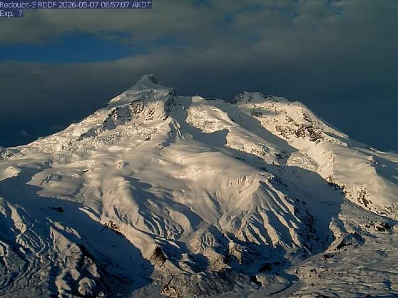
Also nearby: Redoubt - Lowlight Cam (RDJH camera) (0.0 mi) and Redoubt (RDDF camera) (4.0 mi).
Camera radar centered here · More from USGS volcano observatories
Questions about Redoubt (RDJH camera)
Is the Redoubt (RDJH camera) camera live right now?
Yes, it is working: at our last automatic check it was sending new pictures. It is a still image, not video: a new photo arrives about every 10 minutes straight from Alaska Volcano Observatory (USGS).
Who runs this camera?
Alaska Volcano Observatory (USGS) runs this camera, as part of the U.S. Geological Survey (USGS) Volcano Hazards Program. It is an official source. Its images are in the U.S. public domain. LiveLocation shows them straight from the source with credit. About USGS volcano observatories Watch at the source
Where is the Redoubt (RDJH camera) camera?
It is in United States. Coordinates: 60.591, -152.806.
What time is it at the camera, and is it day or night?
The camera is in the America/Anchorage time zone. The "Right now" panel above shows the local time live. On October 7 the sun rises at 8:33 AM and sets at 7:24 PM there.
Can I see other cameras nearby?
Yes: 2 other cameras are within 25 miles of this one. The live camera radar shows them all on a map, nearest first. Open the radar here
Where can I check the alert level for this volcano?
Alaska Volcano Observatory (USGS) sets the U.S. Volcano Alert Level and Aviation Color Code for this volcano, not LiveLocation. Read its latest update before you plan a visit; the camera alone cannot tell you how safe it is. USGS volcano updates Official camera page
What do the sensors at Redoubt (RDJH camera) show?
The latest readings from the provider: Volcano alert level: NORMAL · aviation code GREEN; Last USGS notice: Apr 23, 2010, 12:27 local time; Issued by: Alaska Volcano Observatory (USGS). They update with the provider's data, so they can be a few minutes old.