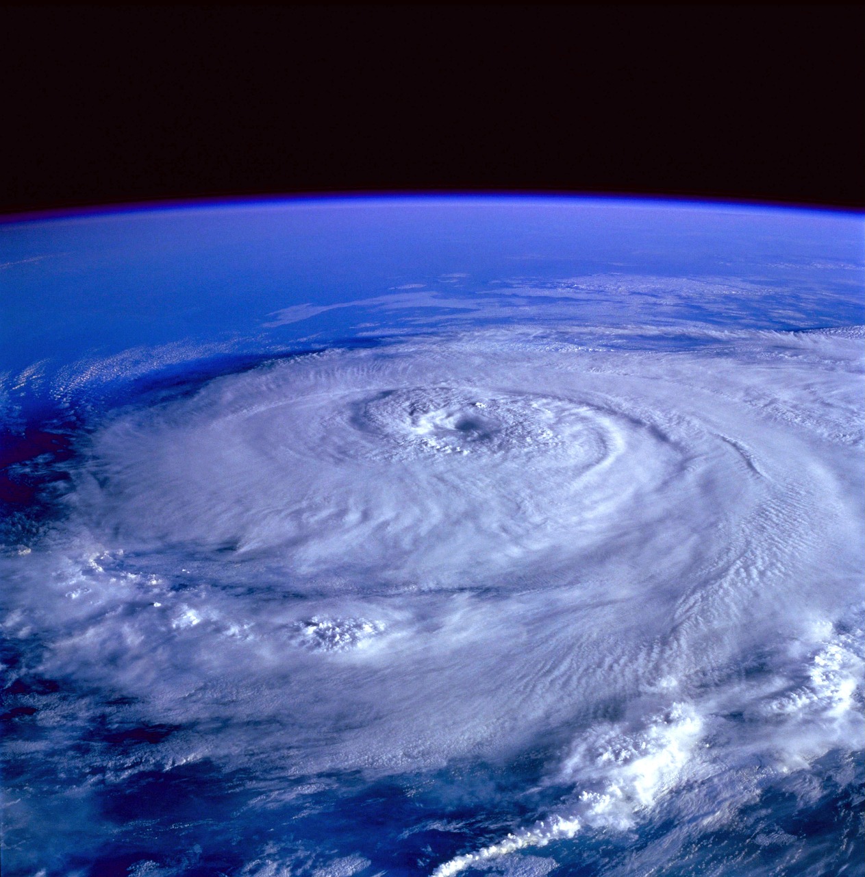
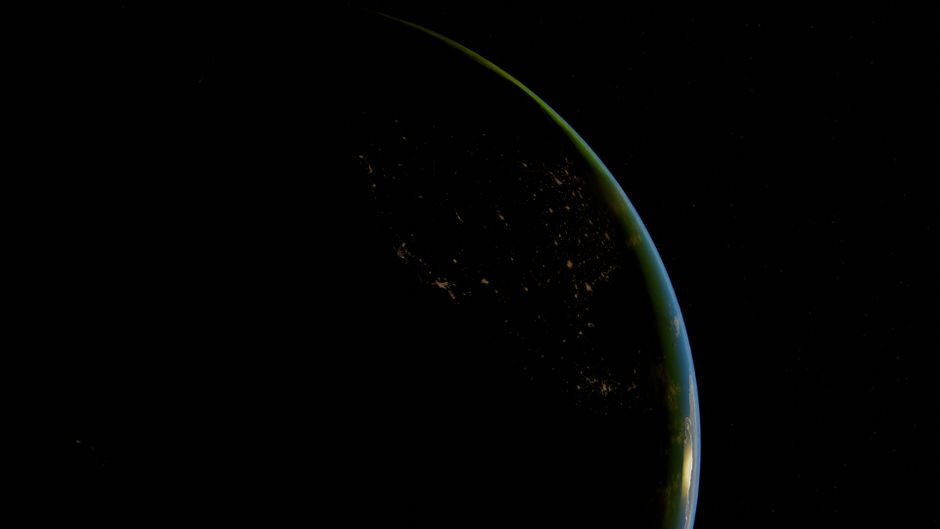
“Live satellite view” is one of the most searched phrases about Earth, and also one of the most misunderstood. No satellite streams continuous video of the whole planet, and the zoomable maps people know (Google Earth, for example) are mosaics of pictures taken weeks, months or years ago. But you can see what the Earth looks like right now, often to within ten minutes, for free, from government satellites. This guide explains which views exist, how fresh each one is and where to watch them.
How live is each view?
Geostationary satellites: the “live” view
A geostationary satellite sits about 22,000 miles (35,800 km) above the equator and moves with the Earth’s rotation, so it always looks at the same half of the planet. That is what makes it ideal for a near-live picture. The United States operates two: GOES-East (currently GOES-19), which sees the Americas and the Atlantic, and GOES-West (currently GOES-18), which sees the western US, Alaska, Hawaii and the Pacific.
Their main camera, the Advanced Baseline Imager, sees in 16 spectral bands of visible and infrared light. According to NOAA, it captures a full-disk image every 10 minutes, an image of the US mainland every five minutes, and one or two smaller areas every 30 to 60 seconds, which forecasters aim at hurricanes, wildfires and severe storms. Add a few minutes of processing and publishing and the newest image is usually 5 to 20 minutes old.
Other countries run their own geostationary satellites for their side of the world: Europe’s Meteosat series (operated by EUMETSAT) over Europe and Africa, and Japan’s Himawari over Asia and the western Pacific. Together they cover almost the whole globe, except the polar regions.
GeoColor: day and night in one picture
The images most people love are called GeoColor: true color by day and infrared at night, with city lights added on the night side. NOAA’s STAR imagery pages describe it as “true color day / IR night”. On a GeoColor loop you can watch the day-night line sweep across the planet and clouds form and dissolve through the afternoon.
Why the poles look stretched
Because geostationary satellites sit over the equator, they see the far north and south at a very low angle. Greenland, northern Scandinavia, Antarctica and the Arctic Ocean look squashed and blurry at the edge of the disk, and the poles themselves are out of view. For those regions, the polar-orbiting satellites below are the better source, and some weather services combine both into composite pictures of the whole globe. On the other hand, the edge of the disk is where you see the thin blue line of the atmosphere against the blackness of space, one of the most beautiful parts of the picture.
Polar-orbiting satellites: the sharp daily map
Satellites in low polar orbits (about 500 miles up) pass over every part of the Earth each day, building up a sharper, true-color picture strip by strip. NASA’s Terra and Aqua (with the MODIS instrument) and the NOAA-NASA satellites carrying VIIRS are the classic sources. NASA’s Worldview website and its tile service GIBS (Global Imagery Browse Services) publish many of these layers in near real time, which NASA defines as within about three hours of observation. Worldview also shows geostationary imagery in 10-minute steps about 40 minutes after capture.
The daily mosaic fills in during the day, so “today” on Worldview may be incomplete in the morning and gaps appear between satellite passes near the equator. On a clear day it shows rivers, lakes, farmland patterns and even the wakes of large ships. It is the best free way to see a hurricane, a dust storm, smoke from fires, snow cover or a volcanic plume in sharp detail.
Comparing the sources
| Source | What you see | How often | How fresh | Where |
|---|---|---|---|---|
| GOES-East / GOES-West (NOAA) | Full disk, US, mesoscale sectors; GeoColor and many bands | 10 min (full disk), 5 min (US), 30 to 60 s (mesoscale) | Minutes | NOAA/NESDIS STAR GOES imagery viewer |
| Meteosat (EUMETSAT), Himawari (JMA) | Europe, Africa; Asia and western Pacific | About every 10 to 15 minutes for full disk | Minutes | The operators’ own image pages |
| NASA Worldview / GIBS | Daily true color, fires, night lights, snow, aerosols; geostationary layers | Daily (polar), 10 min (geo) | About 3 h (polar), about 40 min (geo) | worldview.earthdata.nasa.gov |
| NASA EPIC on DSCOVR | The whole sunlit Earth from about a million miles away | Roughly a dozen images a day | Posted a day or more later | epic.gsfc.nasa.gov |
| NASA ISS live stream | Real video of Earth from about 250 miles up | Continuous (with night and signal gaps) | Seconds | nasa.gov/live |
| Map apps’ satellite layers | Very sharp mosaics for zooming | Updated now and then | Often months or years | Map apps |
Live views of Earth on LiveLocation
Our Earth now page puts the latest GOES imagery, NASA’s daily true-color map, weather radar and the day-night line on one map, and every camera page shows the satellite view for that spot. The cards below are live Earth-from-space views from our map.
 Live nowYouTube liveHigh-definition views from the International Space Station (official NASA stream)
 Live nowYouTube liveSen 4K live view of Earth from the ISS
For live video from orbit, see the official space station streams and our guide Is the ISS feed real?.
What the colors and bands mean
Weather satellites see much more than our eyes. The 16 bands of the GOES imager range from visible light to several kinds of infrared, and each one answers a different question:
| View | What it shows | When it helps |
|---|---|---|
| True color / GeoColor | The Earth roughly as your eyes would see it by day; infrared and city lights at night | The “wow” view: clouds, deserts, smoke, snow |
| Visible (red band) | The sharpest black-and-white daytime detail | Thunderstorm tops, fog, small-scale cloud features |
| Clean infrared | Temperature of cloud tops and the ground, day and night | Storm strength: the colder (brighter) the top, the stronger the storm |
| Water vapor | Moisture in the middle and upper atmosphere | Jet streams, dry air, the big weather patterns |
| Fire and smoke products | Hot spots and smoke plumes | Wildfires and big volcanic eruptions |
A five-minute tour of Earth now
- Start with the full disk. On NOAA’s GOES viewer, open the GOES-East full-disk GeoColor loop and watch the last few hours: the day-night line, afternoon thunderstorms over land, swirling lows over the ocean.
- Zoom to a storm. If a hurricane or big storm is active, open the mesoscale sector that follows it and watch one-minute images.
- Switch to the daily map. In NASA Worldview, look at today’s true-color layer for your region; turn on fires or snow cover.
- Go to the ground. Find a webcam under the clouds you just watched on our map.
Can I see my house live from space?
No, not from any free public source. Geostationary images show details around 0.5 to 2 kilometers across, enough for clouds and big fires but not buildings. Daily polar images show about 250 meters to 1 kilometer. Satellites that can see cars and houses take pictures on request for paying customers and are not live streams. The sharp satellite layer in map apps is a mosaic of older images. If you want to see a place right now, a ground webcam is the answer: find cameras near you or search the map.
How to tell if a “live satellite” video is real
- Look at the time stamp. Real satellite imagery carries the scan time, usually in UTC.
- Check the day-night line. It must match the current time of day. If it’s evening in Europe, Europe should be in shadow.
- Compare the weather. A hurricane in the picture should be in today’s forecasts.
- Be wary of perfect spinning globes. A cloud-free, evenly lit Earth spinning on YouTube is an animation, not a live feed.
Good to know
- US government imagery from NOAA and NASA is generally public domain; NASA asks for a credit such as “Imagery: NASA GIBS / ESDIS”, and NOAA imagery is credited “NOAA/NESDIS/STAR”. That is what we show on our maps.
- Infrared images work at night because they measure heat; cold, high cloud tops look bright, which is how forecasters spot strong storms.
- Satellites help volcano watchers too: big ash plumes appear on GOES within minutes (see best volcano cams).
- Want the technical background? Read satellite imagery explained.
Do these next
- Open Earth now for the latest satellite view.
- Explore NASA Worldview for today’s true-color map.
- Find a ground camera to see a place up close.
Questions people ask
Is there a live satellite view of Earth?
Nearly. NOAA’s GOES satellites take a full-disk image every 10 minutes and the US every 5 minutes, so the latest image is usually minutes old. Continuous live video comes from cameras on the International Space Station.
How often do GOES satellites take pictures?
The Advanced Baseline Imager captures a full disk every 10 minutes, the continental US every 5 minutes, and one or two smaller areas every 30 to 60 seconds.
How recent is NASA Worldview imagery?
NASA says near real-time layers are available within about three hours of observation, and geostationary imagery in 10-minute steps about 40 minutes after capture.
Can I see my house live from a satellite?
No. Free near-live satellite images show clouds and large features, not houses. The sharp satellite layers in map apps are older mosaics. A ground webcam is the way to see a place right now.
Which GOES satellite covers which area?
GOES-East (currently GOES-19) covers the Americas and Atlantic; GOES-West (currently GOES-18) covers the western US, Alaska, Hawaii and the Pacific.
Sources
- NOAA NESDIS: Advanced Baseline Imager (ABI) (checked 2026-10-07)
- NOAA/NESDIS/STAR: GOES imagery viewer (checked 2026-10-07)
- NASA Earthdata: Worldview (checked 2026-10-07)
- NASA Earthdata: Data latency (near real-time definition) (checked 2026-10-07)
- NASA Earthdata: Global Imagery Browse Services (GIBS) APIs (checked 2026-10-07)
- NASA EPIC (DSCOVR) image archive (checked 2026-10-07)
- NASA Live (checked 2026-10-07)
Last reviewed October 7, 2026 by the LiveLocation team. General information, not legal or electrical advice.