Live cameras in Manukau City, New Zealand
39 cameras: 0 live video, 39 still images · 39 working now · updated Oct 8, 03:30 UTC
Manukau City has 39 live cameras on LiveLocation right now: 0 live video, 39 still images. Good places to start: SH20 Portage Rd South, Auckland, SH20 Bader Dr Overbridge, Auckland, SH20A George Bolt Mem Dr North, Auckland. Local time is 4:30 PM (Pacific/Auckland). Today the sun rises at 6:47 AM and sets at 7:29 PM.
Manukau City live cameras
Every Manukau City live camera we know of: 0 live video, 39 still images. 39 of them were live or fresh at the last check. Manukau City is home to about 362,000 people.
Weather now in Manukau City: 18 °C (64 °F), clear sky, wind 18 km/h (11 mph) from the southwest. Forecast for 5 PM local time. Weather: MET Norway (CC BY 4.0)
 WorkingStill imageSH20 Portage Rd South, Auckland
 WorkingStill imageSH20 Bader Dr Overbridge, Auckland
 WorkingStill imageSH20A George Bolt Mem Dr North, Auckland
 WorkingStill imageSH20 Rimu Rd, Auckland
 WorkingStill imageSH20 Barrowcliffe Pl Overbridge, Auckland
 WorkingStill imageSH20 Lambie Dr, Auckland
 WorkingStill imageSH20 Gt South Rd, Auckland
 WorkingStill imageSH1 Redoubt Rd, Auckland
 WorkingStill imageSH1/SH20 Interchange South, Auckland
 WorkingStill imageSH1/SH20 Interchange North, Auckland
 WorkingStill imageSH20 Plunket Ave Overbridge, Auckland
 WorkingStill imageSH20 Cavendish Dr, Auckland
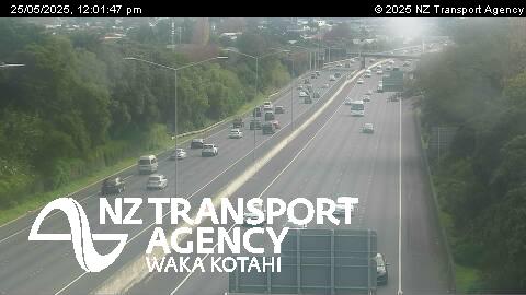 WorkingStill imageSH1 Orams Rd, Auckland
 WorkingStill imageSH20 Puhinui Rd, Auckland
 WorkingStill imageSH1 Hill Road, Auckland
 WorkingStill imageSH20B Prices Rd, Auckland
 WorkingStill imageSH1 Alfriston Rd Overbridge, Auckland
 WorkingStill imageSH1 Bairds Rd Overbridge, Auckland
 WorkingStill imageSH1 Takanini, Auckland
 WorkingStill imageSH20 Portage Rd North, Auckland
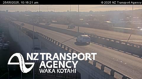 WorkingStill imageSH1 Takanini Interchange, Auckland
 WorkingStill imageSH20 Massey Rd, Auckland
 WorkingStill imageSH1 Walter Strevens Dr Overbridge, Auckland
 WorkingStill imageSH1 Pahurehure Inlet, Auckland
 WorkingStill imageSH20/20A Interchange, Auckland
 WorkingStill imageSH20A Bader Dr Overbridge, Auckland
 WorkingStill imageSH20A George Bolt Mem Dr South, Auckland
 WorkingStill imageSH1 Papakura, Auckland
 WorkingStill imageSH20 Coronation Rd, Auckland
 WorkingStill imageSH20 Hastie Ave Footbridge, Auckland
 WorkingStill imageSH1 South Eastern Hwy, Auckland
 WorkingStill imageSH20 Onehunga Wharf, Auckland
 WorkingStill imageSH20 Gloucester Park Rd, Auckland
 WorkingStill imageSH1 Park Estate Rd Overbridge, Auckland
 WorkingStill imageSH1 Slippery Creek, Auckland
 WorkingStill imageSH20 Queenstown Rd, Auckland
 WorkingStill imageSH20 Hillsborough Rd, Auckland
 WorkingStill imageSH1 Greenlane Interchange, Auckland
 WorkingStill imageSH20 Hayr Rd Overbridge, Auckland
No live video among these cameras. Turn off "Live video only" to see them all.
Best cams to watch
- SH20 Portage Rd South, Auckland — Still image · every 2 min, working 100 % of the time in the last 30 days.
- SH20 Bader Dr Overbridge, Auckland — Still image · every 2 min, working 100 % of the time in the last 30 days.
- SH20A George Bolt Mem Dr North, Auckland — Still image · every 2 min, working 100 % of the time in the last 30 days.
Manukau, often called Manukau City or Manukau Central, is the commercial heart of South Auckland, about twenty-three kilometers south of Auckland's central business district. The name comes from the nearby Manukau Harbour and is usually translated from Māori as only birds. Until the 1960s this was farmland. The Manukau City Council, formed in 1965, bought land here and built a new town center around Westfield Manukau City, which opened in 1976, and a civic building that followed a year later. The council merged into the single Auckland Council in 2010, but the name lives on in the shopping district, the train station and the busy transport hub. The Rainbow's End theme park sits next to the center, and the Auckland Botanic Gardens are a few minutes south.
The cameras here
The cameras that call Manukau home are NZTA Waka Kotahi state highway cameras, still images refreshed every few minutes. Manukau is where the Southwestern Motorway, State Highway 20, meets the Southern Motorway, State Highway 1, so the views are mostly of that junction and the motorway lanes on either side. State Highway 20 also leads west toward Auckland Airport, which makes these images useful for anyone checking traffic before a flight.
South Auckland's clocks match the rest of the country: UTC plus twelve, or plus thirteen while daylight saving runs from late September to early April. The motorway junction is busiest on weekday mornings heading north toward the city and on weekday evenings heading south, and traffic can also build on Saturdays around the shopping center and Rainbow's End. The weather is mild and often damp; heavy rain showers are more of a driving hazard here than cold.
When the motorway views have told you enough, try the cameras of central Auckland a short way north, or look at the area around the airport at Māngere, where planes come and go over the Manukau Harbour.
Sources: Manukau - Wikipedia · NZTA Waka Kotahi traffic and travel · Auckland Botanic Gardens.
Nearby places
- Auckland (91)
- Papatoetoe (45)
- Otahuhu (27)
- Mount Eden (25)
- Mangere (24)
- Otara (24)
- Avondale (23)
- Manurewa (22)
Questions about Manukau City
How many cameras does LiveLocation have in Manukau City?
LiveLocation lists 39 cameras in and around Manukau City, New Zealand: 0 live video, 39 still images. 39 of them were live or showing a fresh image at the last check.
Where do the Manukau City cameras come from?
All of them come from NZTA Waka Kotahi (39). Each camera plays straight from the agency or owner that runs it, with credit. NZTA Waka Kotahi
What kinds of views are there in Manukau City?
All of them show traffic and highway (39). Good ones to start with: SH20 Portage Rd South, Auckland and SH20 Bader Dr Overbridge, Auckland. SH20 Portage Rd South, Auckland SH20 Bader Dr Overbridge, Auckland
Is there live video from Manukau City?
Not yet: the cameras here send still images that refresh about every 2 minutes. The map can show only live-video cameras nearby. Live video on the map
When is the best time to watch the Manukau City cameras?
Manukau City is on Pacific/Auckland time. On October 8 the sun rises at 6:47 AM and sets at 7:29 PM, so still images are clearest between those times. Road cameras show the most traffic in the weekday morning and evening rush hours.
Are there live cameras near Manukau City?
The nearest are Manurewa (2.8 km away, 22 cameras), Papatoetoe (4.5 km away, 45 cameras) and Otara (5.0 km away, 24 cameras). Manurewa Papatoetoe Otara
Is there a map of the cameras in Manukau City?
The map at the top of this page shows all 39 of them. The live camera radar centers on Manukau City and lists every camera within 5 to 250 km, nearest first, with filters for live video, traffic, nature and more. Open the radar on Manukau City
Place names and locations: GeoNames, licensed under CC BY 4.0.