Live cameras in Akureyri, Iceland
37 cameras: 0 live video, 37 still images · 37 working now · updated Oct 8, 03:32 UTC
Akureyri has 37 live cameras on LiveLocation right now: 0 live video, 37 still images. Good places to start: Lónsbakki, Road 1 (Norðurlandsvegur), view 3, Grenivíkurvegur, Road 83 (Grenivíkurvegur), looking north, Fljótsheiði, Road 1 (Hringvegur), road surface view. Local time is 3:32 AM (Atlantic/Reykjavik). Today the sun rises at 7:45 AM and sets at 6:14 PM.
Akureyri live cameras
Akureyri live cameras, all in one place: 0 live video, 37 still images. 37 of them were live or fresh at the last check. Akureyri is home to about 19,000 people.
Weather now in Akureyri: 2 °C (35 °F), cloudy, wind 7 km/h (4 mph) from the southeast. Forecast for 4 AM local time. Weather: MET Norway (CC BY 4.0)
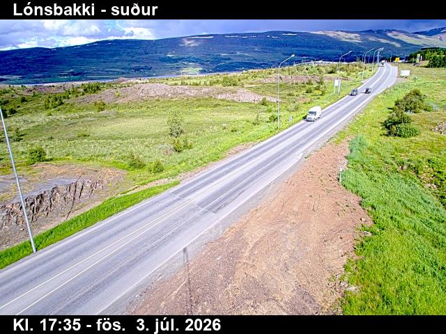 WorkingStill imageLónsbakki, Road 1 (Norðurlandsvegur), view 3
 WorkingStill imageGrenivíkurvegur, Road 83 (Grenivíkurvegur), looking north
 WorkingStill imageFljótsheiði, Road 1 (Hringvegur), road surface view
 WorkingStill imageBakkaselsbrekka, Road 1 (Hringvegur), view 3
 WorkingStill imageÖxnadalsheiði, Road 1 (Hringvegur), looking east
 WorkingStill imageÓlafsfjarðarvegur við Sauðanes, Road 82 (Ólafsfjarðarvegur), looking south
 WorkingStill imageVaðlaheiðargöng - vestur, Road 1 (Hringvegur), looking west
 WorkingStill imageVaðlaheiðargöng - vestur, Road 1 (Hringvegur), looking west
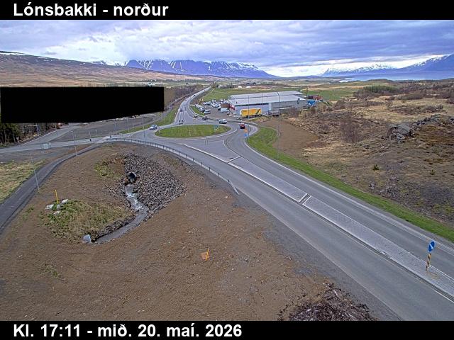 WorkingStill imageLónsbakki, Road 1 (Norðurlandsvegur), view 1
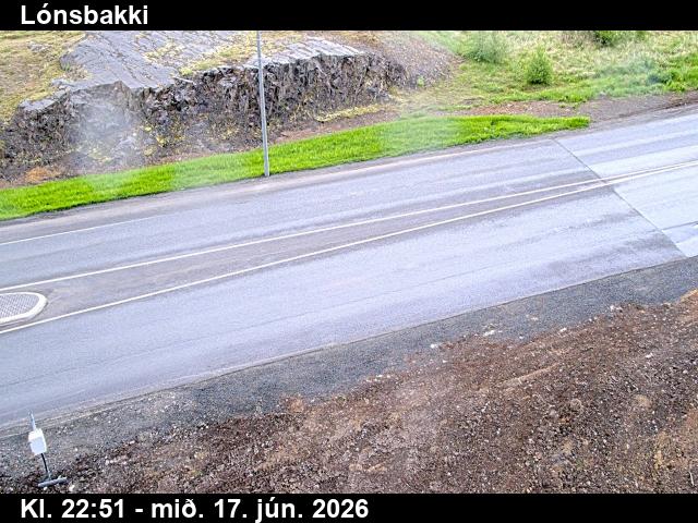 WorkingStill imageLónsbakki, Road 1 (Norðurlandsvegur), view 2
 WorkingStill imageVaðlaheiðargöng - austur, Road 1 (Hringvegur), looking east
 WorkingStill imageVaðlaheiðargöng - austur, Road 1 (Hringvegur), looking east
 WorkingStill imageVíkurskarð, Road 84 (Víkurskarð), looking west
 WorkingStill imageVíkurskarð, Road 84 (Víkurskarð), road surface view
 WorkingStill imageVíkurskarð, Road 84 (Víkurskarð), looking east
 WorkingStill imageKaldakinn, Road 85 (Norðausturvegur), view 1
 WorkingStill imageKaldakinn, Road 85 (Norðausturvegur), road surface view
 WorkingStill imageKaldakinn, Road 85 (Norðausturvegur), view 3
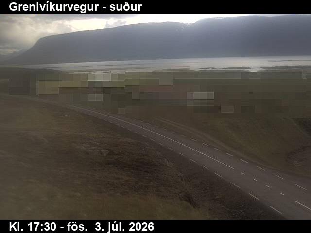 WorkingStill imageGrenivíkurvegur, Road 83 (Grenivíkurvegur), looking south
 WorkingStill imageGrenivíkurvegur, Road 83 (Grenivíkurvegur), road surface view
 WorkingStill imageGrenivíkurvegur, Road 83 (Grenivíkurvegur), looking northwest
 WorkingStill imageFljótsheiði, Road 1 (Hringvegur), view 1
 WorkingStill imageFljótsheiði, Road 1 (Hringvegur), view 3
 WorkingStill imageHámundarstaðaháls, Road 82 (Ólafsfjarðarvegur), looking south
 WorkingStill imageHámundarstaðaháls, Road 82 (Ólafsfjarðarvegur), road surface view
 WorkingStill imageHámundarstaðaháls, Road 82 (Ólafsfjarðarvegur), looking west
 WorkingStill imageBakkaselsbrekka, Road 1 (Hringvegur), view 1
 WorkingStill imageBakkaselsbrekka, Road 1 (Hringvegur), road surface view
 WorkingStill imageÖxnadalsheiði, Road 1 (Hringvegur), looking west
 WorkingStill imageÖxnadalsheiði, Road 1 (Hringvegur), road surface view
 WorkingStill imageMývatnsheiði, Road 1 (Hringvegur), view 1
 WorkingStill imageMývatnsheiði, Road 1 (Hringvegur), road surface view
 WorkingStill imageMývatnsheiði, Road 1 (Hringvegur), view 3
 WorkingStill imageÓlafsfjarðarvegur við Sauðanes, Road 82 (Ólafsfjarðarvegur), road surface view
 WorkingStill imageÓlafsfjarðarvegur við Sauðanes, Road 82 (Ólafsfjarðarvegur), looking north
 WorkingStill imageMúlagöng suður, Road 82 (Ólafsfjarðarvegur), view 1
 WorkingStill imageMúlagöng suður, Road 82 (Ólafsfjarðarvegur), road surface, looking south
No live video among these cameras. Turn off "Live video only" to see them all.
Best cams to watch
- Lónsbakki, Road 1 (Norðurlandsvegur), view 3 — Still image · every 10 min, working 100 % of the time in the last 30 days.
- Grenivíkurvegur, Road 83 (Grenivíkurvegur), looking north — Still image · every 10 min, working 100 % of the time in the last 30 days.
- Fljótsheiði, Road 1 (Hringvegur), road surface view — Still image · every 10 min, working 100 % of the time in the last 30 days.
Akureyri is the largest town in Iceland outside the capital region, a fishing and university town of about 20,000 people at the head of Eyjafjörður, the country's longest fjord. It lies in the north, about a hundred kilometers south of the Arctic Circle and roughly 390 kilometers from Reykjavík by road. Mountains shelter the town, which gives it a relatively mild climate for its latitude and allows a botanical garden to grow plants outdoors without greenhouses. The steps up to Akureyrarkirkja church lead to views over the fjord, and the Hlíðarfjall ski area on the slopes just west of town is one of the main winter draws. The airport handles domestic and some international flights, and whale-watching boats leave from the harbor in summer.
What the cameras show
The cameras grouped under Akureyri are Vegagerðin road-weather webcams, run by the Icelandic Road and Coastal Administration. A new picture from each one arrives every few minutes. In this part of the north they look along the Ring Road, Route 1, and other roads around Eyjafjörður. Route 1 heads west over the high Öxnadalsheiði pass toward Skagafjörður, where snow and wind often affect driving, and east through the Vaðlaheiðargöng tunnel, opened at the end of 2018, toward Lake Mývatn. The views help drivers judge snow cover and visibility before setting out.
- Midsummer: nearly round-the-clock daylight around the June solstice
- Midwinter: only a few hours of low daylight in December
- Northern lights: possible on clear, dark nights from about September to April
Akureyri uses Greenwich Mean Time all year, with no clock changes. Being farther north than Reykjavík, it has even shorter winter days and brighter summer nights. Winter storms can close the mountain passes for a time, and the road-weather images are often the first sign of a change.
Nearby, the Goðafoss waterfall lies east along Route 1 past the tunnel, and the island of Hrísey, reached by a short ferry from Árskógssandur, sits in the middle of the fjord.
Sources: Akureyri - Wikipedia · Vegagerðin (Icelandic Road and Coastal Administration) - road conditions and webcams · Vaðlaheiðargöng - Wikipedia.
Nearby places
- Reykjavík (73)
- Hafnarfjörður (57)
- Kópavogur (36)
Questions about Akureyri
How many live cameras are there in Akureyri?
LiveLocation lists 37 cameras in and around Akureyri, Iceland: 0 live video, 37 still images. 37 of them were live or showing a fresh image at the last check.
Where do the Akureyri cameras come from?
All of them come from Vegagerðin (37). Each camera plays straight from the agency or owner that runs it, with credit. Vegagerðin
What kinds of views are there in Akureyri?
All of them show pass and road weather (37). Good ones to start with: Lónsbakki, Road 1 (Norðurlandsvegur), view 3 and Grenivíkurvegur, Road 83 (Grenivíkurvegur), looking north. Lónsbakki, Road 1 (Norðurlandsvegur), view 3 Grenivíkurvegur, Road 83 (Grenivíkurvegur), looking north
Is there live video from Akureyri?
Not yet: the cameras here send still images that refresh about every 10 minutes. The map can show only live-video cameras nearby. Live video on the map
When is the best time to watch the Akureyri cameras?
Akureyri is on Atlantic/Reykjavik time. On October 8 the sun rises at 7:45 AM and sets at 6:14 PM, so still images are clearest between those times. Road cameras show the most traffic in the weekday morning and evening rush hours.
Is there a map of the cameras in Akureyri?
The map at the top of this page shows all 37 of them. The live camera radar centers on Akureyri and lists every camera within 5 to 250 km, nearest first, with filters for live video, traffic, nature and more. Open the radar on Akureyri
Place names and locations: GeoNames, licensed under CC BY 4.0.